Get shapefile of GIFT regions for selected regions.
Usage
GIFT_shapes(
  entity_ID = NULL,
  api = "https://gift.uni-goettingen.de/api/extended/",
  GIFT_version = "latest"
)
Arguments
- entity_ID
A vector defining the IDs of the regions.
- api
character string defining from which API the data will be retrieved.
- GIFT_version
character string defining the version of the GIFT database to use. The function retrieves by default the
lateststable version. If set tobeta, the most up-to-date version which is still subject to changes and edits is used.
Details
Here is the detail of each column:
entity_ID - Identification number of the polygon
geo_entity - Name of the polygon
point_x - Longitude of the centroid of the polygon
point_y - Latitude of the centroid of the polygon
area - Area in km2 of the polygon
x_min - Minimum longitude of the polygon
x_max - Maximum longitude of the polygon
y_min - Minimum latitude of the polygon
y_max - Maximum latitude of the polygon
entity_class - Class of the polygon
entity_type - Type of the entity
polygon_source - Source of the polygon
geometry - Geometry column from sf
References
 Denelle, P., Weigelt, P., & Kreft, H. (2023). GIFT—An R package to
 access the Global Inventory of Floras and Traits. Methods in Ecology
 and Evolution, 14, 2738-2748.
 https://doi.org/10.1111/2041-210X.14213

 Weigelt, P, König, C, Kreft, H. GIFT – A Global Inventory of Floras and
 Traits for macroecology and biogeography. J Biogeogr. 2020; 47: 16– 43.
https://doi.org/10.1111/jbi.13623Examples
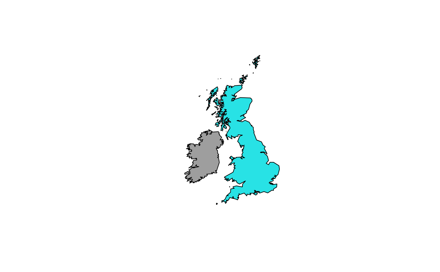
# \donttest{
ex <- GIFT_shapes(entity_ID = c(677, 200))
#> You are asking for the latest stable version of GIFT which is 3.2.
#> ================================================================================
plot(sf::st_geometry(ex), col = ex$entity_ID)

# }
# }